
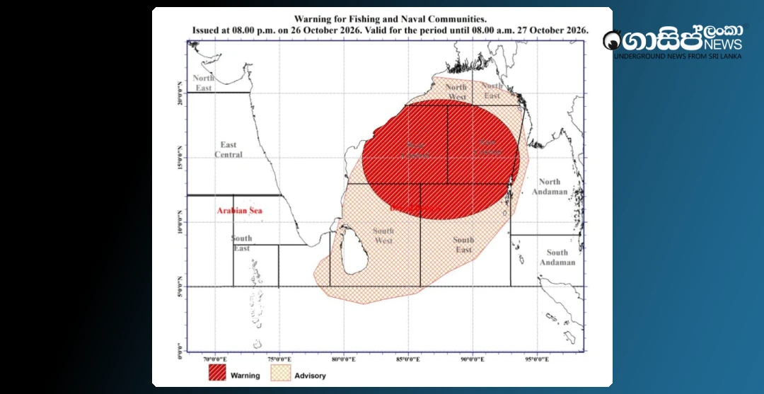
Sri Lanka's sea areas and land are facing a severe risk due to the "Arnab" cyclone that has developed in the Bay of Bengal sea area and the deep depression affecting the island. In light of this situation, the Department of Meteorology has issued red alert warnings to the fishing and naval communities as well as the general public.
As of 2:30 PM on October 26, 2026, Cyclone Arnab was centered approximately 1050 km northeast of Kankasanthurai. It is expected to move west-northwestwards, intensifying into a severe cyclonic storm over the west-central Bay of Bengal, and further into a very severe cyclonic storm by October 27. This system is predicted to make landfall over India's Andhra Pradesh region around 11:30 AM on October 28.
In light of this situation, wind speeds in the sea areas between 10 and 20 degrees North Latitude and 80 and 95 degrees East Longitude could intermittently increase to 80-100 kmph, with sea waves rising to 3.0-4.0 meters, making these areas very rough. In the deep and shallow sea areas from Colombo to Mullaitivu via Galle, Matara, Hambantota, Pottuvil, and Batticaloa, wind speeds could also increase to 60-65 kmph, making these areas intermittently very rough. Due to this, the fishing community has been strongly advised not to venture into the relevant sea areas.
Meanwhile, due to the depression in the Bay of Bengal intensifying into a deep depression, the prevailing rainy conditions across the island are expected to continue for the next few days. Accordingly, heavy rainfall exceeding 100 mm is predicted for the Northern, Western, Sabaragamuwa, North Western, Central, and Southern provinces, as well as some places in the Anuradhapura district.
Between 8:30 AM on October 25 and 3:00 AM on October 26, the highest rainfall of 163 mm was recorded in the Punarin area of Kilinochchi. Additionally, significant rainfall of 148 mm was reported from the Illuppaikkadavai area in Mannar, and 110 mm from the Tholpuram area in Jaffna. Authorities urge close attention to these weather conditions.


